Census 2016 winners and losers across Canada

The first release of data from the 2016 census shows Canada’s G7-leading population growth continues, largely due to immigration, but it varies considerably from west to east and in rural versus urban areas.
As of Census Day (May 10, 2016), Canada’s population was just over 35 million — ten times more than it was in Canada’s first census as a new nation in 1871. It’s also up 5.0 per cent (1.7 million) since the 2011 census. About two-thirds of that growth came from migration to the country, Statistics Canada said in its report released Wednesday, and the other third via births. Canada still has the highest growth rate of the G7 countries — a distinction the country has now held for 15 years — but there are significant regional disparities in growth across the nation.
The 2016 census shows there has been a significant population shift from east to west. In 1871, the majority of Canada’s population lived in Ontario, Quebec, New Brunswick, and Nova Scotia. Meanwhile, western Canada was only sparsely populated. But by 2016, almost a third of Canada’s population lived in the four western provinces of British Columbia, Alberta, Saskatchewan, and Manitoba.
WINNERS
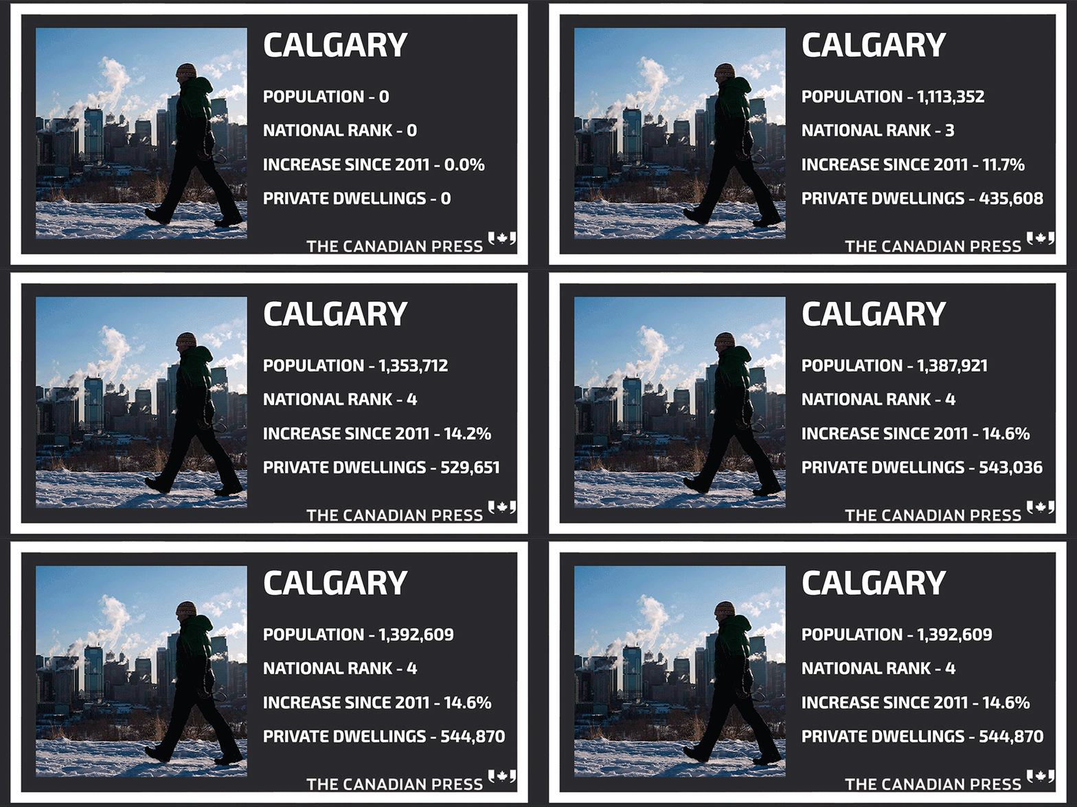
Alberta: Despite a slump in the resource sector and the Fort McMurray wildfire, Alberta had the highest population growth between 2011 and 2016 (more than any other province), with a rate of 11.6 per cent. The metropolitan area of Edmonton grew 13.9 per cent to 1,321,426 from 2011 to 2016, according to StatsCan, and Calgary is still the fastest-growing city in Canada with a 14.6 per cent growth.

The rest of Western Canada: British Columbia, Saskatchewan, and Manitoba expanded their populations at a slower rate than Alberta, but all showed growth above the national average. Between 2011 and 2016, the populations of Saskatchewan (6.3 per cent), Manitoba (5.8 per cent), and British Columbia (5.6 per cent) all grew faster than the overall Canadian population (5.0 per cent). This is the first time since Confederation that all three prairie provinces are at the top of the growth-rate charts for the country.
Smaller cities: Though the news was less positive for New Brunswick on the whole (more details below), the 2016 census shows that Moncton is now the province’s largest city after surpassing Saint John, the previous population leader. Moncton’s population increased 4.1 per cent to 71,889 from 2011 to 2016. In comparison, Saint John’s population fell 3.6 per cent to 67,575. Paradise, NL, also cracked the list of fastest growing areas in Canada. In 1981, the town had just 2,861 people. By 2016, the population grew to 21,389 — up 20 per cent and about 3,500 people from 2011. Others small cities, such as Windsor, Saguenay and St. Catherine’s-Niagara, also grew in population.
Nunavut: Even though Alberta had the fastest provincial growth rate, the fastest growth of all was seen in Nunavut, which grew by 12.7 per cent between 2011 and 2016. The growth can be attributed to Nunavut having the highest fertility rates in the country. Women in Nunavut birth an average of 2.9 children versus the national average of 1.6 children.
LOSERS
New Brunswick: The Atlantic provinces showed slow population growth overall, but only New Brunswick went down in population between 2011 and 2016 — the first time since 2006 that any province has shown negative growth. According to the latest census, the province’s population dropped to 747,101 people (or 0.5 per cent) between 2011 and 2016. That’s a decrease of 4,070 people over five years, after a growth rate of 2.9 per cent from 2006 to 2011.
The rest of Atlantic Canada: The other three Atlantic provinces showed population growth in the 2016 census by the narrowest of margins. In P.E.I., the population grew 1.9 per cent from 2011 to 2016. In Newfoundland and Labrador, the growth rate was 1 per cent in five years —
down considerably from the 1.8 per cent growth rate seen from 2006 to 2011. And Nova Scotia just barely grew since the last census, with the population going up 0.2 per cent — the third-worst growth rate in the province’s history. Also, in 1966 10 per cent of Canada’s population lived in Atlantic Canada, but in 2016 only 6.6 per cent did. StatsCan said the lower growth rates in Atlantic Canada are due to a combination of interprovincial migration, low immigration levels, and higher death rates relative to births because of older-than-average populations.
Rural Canada: The population decreased in several rural areas across the country, from coast to coast. In Newfoundland and Labrador, more than 200 towns had smaller populations in 2016 than they did in 2011, StatsCan data showed. And municipalities further from urban centres (like Elliot Lake, ON, and New Glasgow, N.S.,) were more likely to show a decline in population than those close to a larger city.
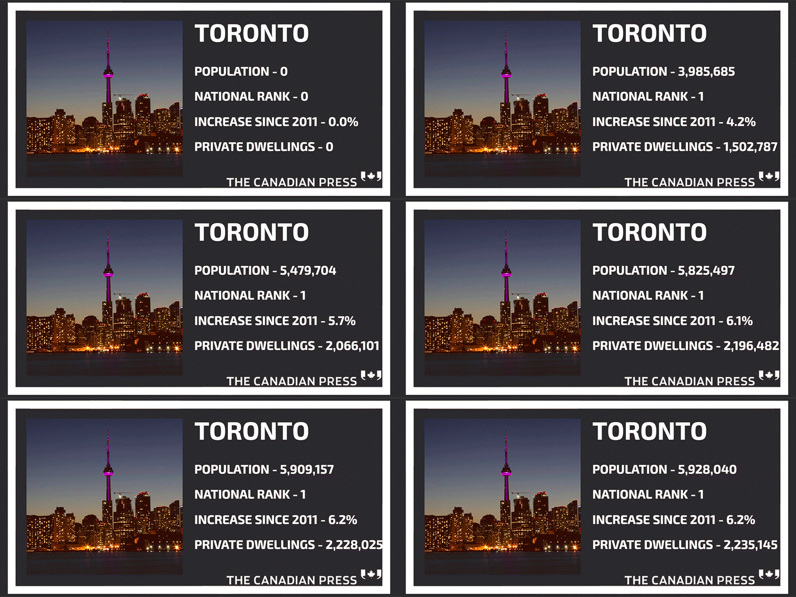
Ontario: Ontario remained Canada’s most heavily populated province as of 2016 with 13.4 million people, which accounts for 38.3 per cent of the country’s total population. But at 4.6 per cent, Ontario’s growth rate was below the national average for the second consecutive intercensal period. That hasn’t happened since the Second World War.


 Yahoo Finance
